Oceans, Climate and Atmosphere
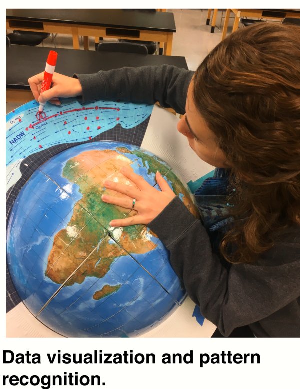
Spherical rulers, manipulatives and overlays are great tools for the classroom!
 The Coriolis Effect Lesson Activity
Authored by Will Robertson, Upper School Science Teacher at Stone Ridge School of the Sacred Heart, Bethesda, MD
In the southern hemisphere of a planet rotating from west to east (such as the Earth), the direction of the Coriolis force acts perpendicularly to the LEFT of the direction of fluid flow.
Download Coriolis Activity Sheet
Download Coriolis Answer Key
EarthTopoGlobe
Interactive 3D Globe by Weeraratne, D. S.Activity One: Radiocarbon by Ryan H. Glaubke
Activity One: Radiocarbon Answer Key
High School Curriculum
Surface CurrentsSurface Currents (Key)
Thermohaline & Surface Circulation
El Niño and La Niña by Charles Dichiera
College Curriculum
Activity One: Radiocarbon by Ryan H. GlaubkeActivity One: Radiocarbon Answer Key
Thermohaline & Surface Circulation
Additional Curriculum Standards
Math & Science: Exploring Deep-Ocean Water MassesMath & Science: Investigating Surface Currents Around the Globe
 Jet Streams Lesson Activity
by Will Robertson
Jet streams are rapidly moving (80 - 140 mph), relatively narrow (a few hundred miles wide, and often less than three miles thick) streams of air found at the tropopause (the boundary between the troposphere and the overlying stratosphere). There are four major jet streams that encircle the planet - two in the northern hemisphere and two in the southern hemisphere.
Download Jet Streams Activity Sheet
Download Jet Streams Answer Key
Quantifying Plate Tectonics in the Classroom - Magnetic Anomalies, Euler Poles, and Plate Motions on a Sphere
Seafloor Magnetic Anomaly Globe and Map -- download article
Read more about Seafloor Magnetic Anomaly at University of Hawaii, School of Ocean and Earth Science and Technology.
The motivation for development of Seafloor Magnetic Anomaly Globe was a perceived need for accurate magnetic anomaly data on a globe to be used in helping students develop a better understanding of core concepts of plate tectonics.
In concert with a standard Mercator-projection map (using the same data) we hope to provide students with tools to help them (1) improve their understanding of plate tectonics on a sphere, (2) correlate this understanding to its representation on more standard media such as Mercator maps and (3) develop an intuitive understanding of these processes.
Educational Approach
We have designed these globes to be usable across a range of educational levels. They are designed to be accessible to Middle/High School students, but also provide the precision and completeness to allow them to be used by upper-level Geo majors at college-level. Our experience is that even graduate students have found the globes to be the preferred vehicle for initial estimates of rotation parameters, before refining their data using the maps and mathematical analyses.
Kevin Furlong kpf1@psu.edu
Intrinsic to plate tectonics are a range of concepts that revolve around plate motions on a sphere, including rotation poles, angular velocities, and plate boundary kinematics. These concepts were key components in the development of plate tectonic theory, and serve as the underlying quantitative foundation for much of our understanding of plate interactions.
However, in spite of this underlying importance, these concepts remain difficult for students to grasp and quantitatively implement; in part because we often attempt to teach and subsequently use these spherical kinematics (awkwardly) using maps.
In general, globes currently available can be useful for learning these concepts, but are difficult to use in a rigorous manner that allows students to develop an intuitive understanding of plate kinematics, quantify that understanding, and develop the skills to transfer that understanding to comparable data in the more typical map representation. Here we present our approach to addressing this problem - (1) the development of a globe representing the current distribution of marine magnetic anomalies, (2) a comparable map, and (3) examples from a series of learning activities that utilize this global data set to help students discover and understand fundamental processes of plate motions and plate interactions.
Such foundational plate tectonic concepts as rotation poles, angular versus linear velocity, small circles and great circles are all easily envisioned using this explicitly global model and data set. The incorporation of the complete set of marine magnetic anomalies allow these activities to be useful for a range of students from Middle-school through University-level. Importantly students can compare observations and measurements they make on the globes with calculations they do utilizing map data and standard plate motion tools. The globes can be annotated using dry-erase markers, and measuring distances, angles, and orientations on the globe is relatively straightforward.
See more activities
Tools for Lessons & Activities
When used with Real World Globes' Spherical Ruler, these overlays can help enhance the educational experience in the classroom.


Activity Code
/oceanography
HINT: If you are viewing this page from one our Real World Globe activities please make sure the QR code you scanned matches the QR code on this page.
Download free QR Reader/Scanner
HINT: If you are viewing this page from one our Real World Globe activities please make sure the QR code you scanned matches the QR code on this page.
Download free QR Reader/Scanner