About Real World Globes
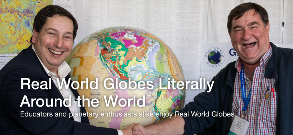
Globes, mapping and teaching is our passion!
 Real World Globes is comprised of a staff of professionals cumulatively bringing to the enterprise over 100 years of experience in mapping, teaching, remote sensing and business.
 Our products are designed to facilitate fun and rewarding learning experiences by employing hands-on visual and spatial learning techniques. These techniques complement and augment typical classroom instruction and enable breakthroughs in understanding and learning.
We stand behind our products with knowledgeable customer service; please do not hesitate to contact us with questions about our visual and spatial learning products.
Who is Joe Roubal?
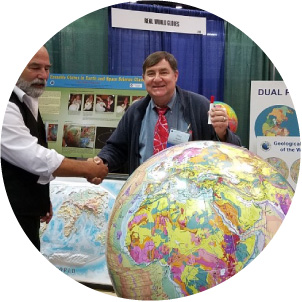
Joe is a self-taught globe maker who has been practicing this ancient art for over 30 years. After studying boat building, cartography and computer programming, he decided to build a fiberglass mold for a 30” hemisphere in 1984. While working in the remote sensing industry for firms including International Imaging Systems, Space Imaging, Digital Globe and ESRI he continued his hobby of making 30” globes. To date, he has built more than 40 large globes.
Early globes were made using paper maps, but the transition to adhesive vinyl allowed maps that are more long lasting. The availability of geographic and astronomical data has allowed Joe to make globes of the Earth along with many planets and moons.
In 2012 Joe partnered with Real World Globes to invent maps and techniques for an 18” globe that could be built by hobbyists as a kit. These techniques were subsequently adapted to support a 10” globe as well. “It has been a great pleasure to share the satisfaction of building globes with others”.
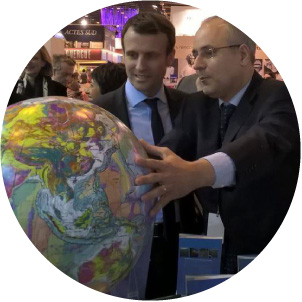
In 2014 Joe collaborated with CCGM (Commission de la Carte Geologique du Monde, the international agency charged with coordinating the geological data from many countries) to create globe maps reflecting the database compiled by Dr. Philippe Bouysse. The resulting globes have been well received at trade shows and have been purchased by universities and museums worldwide. “The need to portray this incredibly detailed data as well as possible has led to refinements in every aspect of the process.” In 2016 Joe retired and moved to Port Townsend, Washington, where he continues to make 30” globes. “The local artists and boatbuilders have inspired me to hold myself to the highest standards, and I am very happy with the way the newest globes are turning out”.
Visit Joe’s web site www.roubalmapping.com to see pictures of the Roubal Mapping Collection of 30” globes and articles he has written about map projections and distortions in world maps.
Chuck Dichiera and Will Robertson work with Real World Globes on lesson activities.
 Charles "Chuck" Dichiera is an educator, mathematician, author, film maker, consultant, researcher and developer. For 34 years he taught math in the public school system, including
20 years of AP Calculus. After retiring from teaching, he began to help Real World Globes with lesson planning, building globes, teaching others how to make globes, creating
how-to videos, working conventions and doing R&D.
Charles "Chuck" Dichiera is an educator, mathematician, author, film maker, consultant, researcher and developer. For 34 years he taught math in the public school system, including
20 years of AP Calculus. After retiring from teaching, he began to help Real World Globes with lesson planning, building globes, teaching others how to make globes, creating
how-to videos, working conventions and doing R&D.  William "Will" Robertson is an Upper School science teacher at Stone Ridge School of the Sacred Heart in Bethesda, Maryland. A Colorado native, he has been teaching high school science courses since 2011 and joined the faculty at Stone Ridge in 2016. He has taught a variety of science courses during his time as an educator, including: biology, chemistry, physics, human anatomy, and biochemistry/bioorganic chemistry. He holds a BA degree in biology (magna cum laude) from
the University of Colorado at Boulder, and a MS degree in chemistry (specializing in organic
chemistry) from The Scripps Research Institute (La Jolla, California).
William "Will" Robertson is an Upper School science teacher at Stone Ridge School of the Sacred Heart in Bethesda, Maryland. A Colorado native, he has been teaching high school science courses since 2011 and joined the faculty at Stone Ridge in 2016. He has taught a variety of science courses during his time as an educator, including: biology, chemistry, physics, human anatomy, and biochemistry/bioorganic chemistry. He holds a BA degree in biology (magna cum laude) from
the University of Colorado at Boulder, and a MS degree in chemistry (specializing in organic
chemistry) from The Scripps Research Institute (La Jolla, California).
Sarah Bremmer is a Geoscientist
with the Wisconsin Geological & Natural History Survey .
with the Wisconsin Geological & Natural History Survey .
 Sarah is a Geoscientist at the University of Wisconsin-Madison Division of Extension. Sarah is fascinated with Earth's natural systems and processes, and how Geoscientists are able to tell so much about our planet's past, present and future by "reading the rocks." Sarah received an A.A. degree from Northwest Florida State College, a B.S. in Geoscience from Northern Arizona University, and an M.S. in Geoscience from the University of Wisconsin-Madison. Sarah authored the 3D Interactive Teaching Lesson Plans for Undergraduate-Level Earth and Ocean Sciences
Why Real World Globes?
Real World Globes provides globe kits and assembled globes for a variety of purposes, from classroom instruction, fun hobby project to handsome home and office displays.
Why are Real World Globes kits better than other globes?
Globe maps display Real World data to accurately represent the actual physiography of planets and moons
Digital maps using satellite imagery and scientific data for unsurpassed accuracy and detail
Mountain ranges, geology, rivers are enhanced for full affect
Bigger is better!
The 18-inch globes are more than twice the size of standard classroom globes
Colossal 30-inch globes are 6 times bigger than standard classroom globes!
More detailed than other globes ~ use a magnifying glass to discover and examine rich information content
Dry-Erase and Wet-Erase surface is great for lessons, discussions and story telling: Real World globes are meant to be handled and marked with dry and wet erase markers
Spatial Learning
Real World Globes' kits add another dimension to geographic and spatial learning, and understanding relationship between features and processes on Earth, as well as other planets and moons. Information-rich satellite data and imagery forms the map base of the globes, along with bathymetric ocean and hydrology data, and unlabeled country boundaries. The easy-to-use dry erase globes makes them useful across educational curricula, transitioning easily from earth science, physical and cultural geography, as well as history and social science. Additional educational modules include math manipulatives for spherical geometry, trigonometry, architecture and navigation.
For Grades 5 thru 12 and Universities
Real world globes, kits and spheres support classroom instruction and curriculum for grades 5 through 12, and universities. The hands-on globe and spherical math manipulative products emphasize spatial and visual learning. These interactive products and techniques unlock your student's potential, and facilitate intuitive and deeper understanding.
Interrelationships and connections between a variety of lessons, topics and disciplines reinforce important principles across disciplines and provides insight. And since the lessons are fun and engaging, learning is natural, exciting and well grounded.
We Love Programs that Work
Real World Globes supports the Virginia Space Grant Consortium, which has received a "Programs That Work" Award from the Virginia Mathematics & Science Coalition for the Virginia Aerospace Science and Technology Scholars Program!
Visit vsgc.odu.edu for more information.