Mars and Venus
Our knowledge of Mars, past and present
 Now, we have THEMIS (Thermal Emission Imaging System) orbiting the red planet. http://themis.asu.edu
Visit our Themis Globe Page
The Thermal Emission Imaging System (THEMIS) is an instrument on board the Mars Odyssey spacecraft. It combines a 5-wavelength visual imaging system with a 9-wavelength infrared imaging system. Mars Odyssey launched from Kennedy Space Center on April 7, 2001 and arrived at Mars on October 24, 2001. It spent the next several months achieving a circular mapping orbit by aerobraking (dipping into the atmosphere to slow and shrink the orbit). Aerobraking concluded in early February 2002, and primary mapping operations began a few weeks later. The spacecraft is in a 2-hour orbit around Mars. As of 2015, it had completed 60,000 orbits of the planet Mars.

Venus, Earth and Mars System Scale
Download System ScaleVenus, Earth & Mars Measuring Tapes for 18" Globe Kit -- print out at 22" for correct scale
Including California State Standards for Mathematical Reasoning & Algebra
plus National Science Standards -- by Charles Dichiera

Arsia Mons Lesson Activity
By William RobertsonDynamo theory: Circulating convection currents of liquid metal in Earth’s outer core is thought to be the source of Earth’s magnetic field. This magnetic field surrounds the Earth (the magnetosphere) and deflects the incoming charged particles of the solar wind around the Earth. By deflecting these high-energy charged particles, the magnetosphere shields the Earth (and its atmosphere) from being stripped away by the momentum of these particles.
For reasons not completely understood, Mars lost its magnetic field billions of years ago. The current primary hypothesis is that Mars’ core cooled and solidified (core crystallization). Without a liquid metal outer core to support convection currents, the dynamo effect was lost, and the magnetic field ceased - leaving Mars’ atmosphere vulnerable to the onslaught of the solar wind.
Download Arsia Mons Elongated Cloud Globe Activity
Download Arsia Mons Answer Key
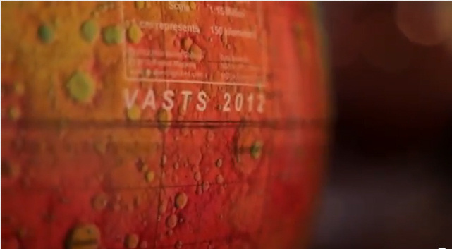
Virginia Aerospace Science and Technology Scholars
VASTS SpacegrantVASTS Summer Academy 2012
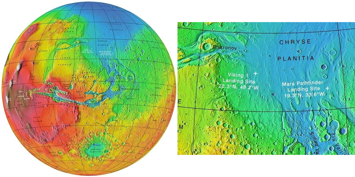
Our Mars Elevation ("MOLA--Mars Orbital Altimeter Laser") is pictured is use by Virginia NASA students.Watch video
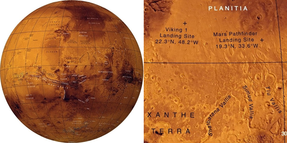
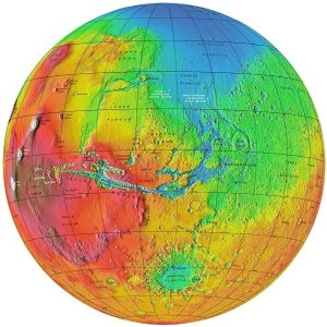
MOLA Research Articles
The Global Topography of Mars and Implications for Surface EvolutionPossible Ancient Oceans on Mars: Evidence from Mars Orbiter Laser Altimeter Data

Activity Code
/mars
HINT: If you are viewing this page from one our Real World Globe activities please make sure the QR code you scanned matches the QR code on this page.
Download free QR Reader/Scanner
HINT: If you are viewing this page from one our Real World Globe activities please make sure the QR code you scanned matches the QR code on this page.
Download free QR Reader/Scanner